Enjoy work enjoy life
Jobs at Aberdeenshire Council
The Planning Service
Situated in the North-east of Scotland, Aberdeenshire is a beautiful and historic region, encapsulating the rugged mountains of the Cairngorms and breath-taking coastal scenery.
Aberdeenshire Council aims to protect and develop this special environment, while delivering first class public services. We believe we have something to offer people of all ages – a quality of life which is hard to find elsewhere.
The Planning Service forms a high performing and busy part of Aberdeenshire Council’s Environment and Infrastructure Service and plays a key role in helping to create and retain sustainable places for the people of Aberdeenshire to live, work and enjoy. The Service is central in helping support the Council’s strategic priorities including economic growth, diversification and regeneration while protecting and promoting the area’s natural and cultural heritage qualities.
Despite the restrictions imposed by the Covid 19- pandemic, our culture of continuous improvements and drive to enhance our quality of service has continued. Significant progress has been made in adapting our working practices and streamlining our processes to transition to a digitally delivered planning system.
Understanding the needs and experiences of our customers has enabled the Service to forge strong collaborative relationships with our communities, the development industry and investors. This has allowed necessary changes to be made to how we deliver the planning system in Aberdeenshire leading to the successful awarding of Customer Service Excellence (CSE) status for the Development Management Section in March 2021.
We are looking for Planners to join our Team:
The area based Development Management Teams of the Planning Service, of which there are three covering Banff & Buchan/Garioch, Buchan/Formartine, and Kincardine & Mearns/Marr (Administrative Map) are responsible for dealing with all statutory functions in relation to development proposals submitted to the Council for planning permission. As one of the busiest Planning Authorities in Scotland, the Teams are performance driven in terms of efficiency in process and decision making, provision of customer care, and delivery of quality sustainable development.
Kincardine & Mearns and Marr Area
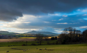
The administrative areas of Kincardine and Mearns and Marr form the largest geographical area within Aberdeenshire. The area extends from the Moray boundary and its eastern reaches of the Cairngorm Mountains in the west, to Huntly and its hinterland in the north-west, to the eastern agricultural areas and coastal settlements lying to the south of the city of Aberdeen and extending to the Angus border.
 The Kincardine and Mearns area primarily occupies the surrounding land either side of the A90 Aberdeen to Dundee Trunk Road from its boundaries with the City of Aberdeen to its border with Angus at the River North Esk. The area includes some of the banks of the eastern part of the River Dee before it enters Aberdeen, and in the wider setting contains traditional agricultural communities, smaller coastal settlements as well as some larger towns. The landscape character is diverse with inland areas dominated by farmland interspersed with settlements. The coastline offers a dramatic landscape and contains important natural and cultural heritage features such as Dunnottar Castle. The central part along the A90 corridor is identified as a Strategic Growth Area and the main settlements include Portlethen, Newtonhill, Stonehaven, Inverbervie, Laurencekirk, St. Cyrus and Fettercairn. The historic tourist coastal town of Stonehaven which is in part a Conservation Area is the administrative base for the Kincardine and Mearns Area Office.
 The Marr area is extensive in size and diverse in character with a range of landscapes and settlements. It includes some eastern parts of the Cairngorms National Park (where Aberdeenshire Council share some planning functions with the Cairngorms National Park Authority) and where there are the historic settlements of Braemar and Ballater which hold Conservation Area status. The River Dee which is a Special Area of Conservation and which flows from the Cairngorms past Balmoral Castle and through other notable settlements including Aboyne, Kincardine O Neil and Banchory, creates the naturally and culturally significant valley of Royal Deeside. The town of Alford which acts as the base for the Marr Area Office is centrally located and is positioned on the River Don which also flows easterly through Strathdon and onwards through Aberdeenshire to the City of Aberdeen. The historic town of Huntly is located on the Rivers Deveron and Bogie to the north of the Marr area conveniently accessed from the A96 Aberdeen to Inverness Trunk Road and the main Aberdeen to Inverness railway line.
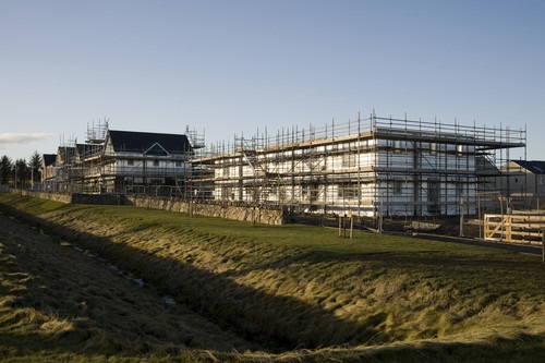 The mix of rural and urban areas results in varied development opportunities. Planning proposals that the team are involved with range in type and scale and include major and local planning applications. Examples amongst others, include, major new town masterplan and residential development, (including Scotland’s most recent new town at Chapelton), larger scale industrial and business proposals, tourism development, smaller scale rural housing and business proposals, renewable energy development including small and large scale wind farm projects, retail, enabling development associated with buildings of historic significance and leisure and community facilities proposals.
Working within the Kincardine and Mearns/Marr Team is considered to provide opportunities to be involved in a diverse range of planning applications which can only help develop professional development management experience.
Formartine and Buchan Area
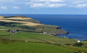
The Formartine and Buchan area of Aberdeenshire is characterised by extensive coastline and coastal settlements to the east and rolling farmland to the west and north of the area. Many of our settlements are designated as Conservation Areas, with 8 in the Buchan area and 3 in the Formartine area this reflects the rich heritage of the north of Aberdeenshire. Both Buchan and Formartine are linked by attractive settlements, many with a host of amenities which enjoy good linkages to Aberdeen by the A90 Trunk Road which runs north from Aberdeen through the area giving good road linkages to the city and beyond.
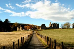
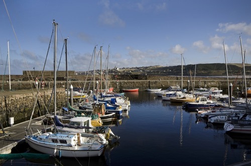
The area includes the attractive market town of Ellon, the coastal port of Peterhead and the historic settlements of Oldmeldrum and Old Deer as well as 19th Century planned villages. The Formartine and Buchan Way runs through the area and is an easily accessible track for walkers, cyclists and runners alike to enjoy. There are numerous cultural assets in the area which include Haddo House, Deer Abbey and Fyvie and Slains Castles. The area is home to high quality golf courses and tourist attractions and hosts some of Aberdeenshire’s top hotel accommodation creating a welcoming place for residents and visitors alike. The area has seen numerous housing developments in recent years adding to the quality and choice of housing stock in the area adding to the attraction of the area.
 The Ellon office is located in the centre of the attractive market town of Ellon in close proximity to local shops and amenities and also close to the River Ythan which is a key asset to the area. Access to the A90 is a few minute drive from the office which is a short distance from 2 main leisure facilities.
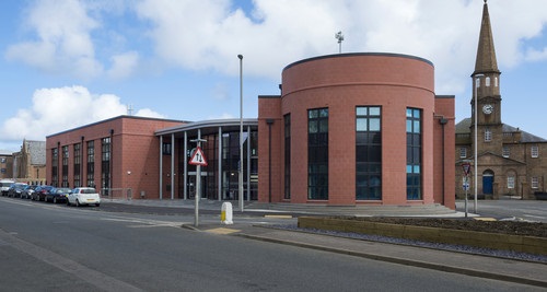
The Peterhead office, Buchan House, is in a purpose built office opened in 2015 and is in a central location close to all of Peterhead’s town centre amenities and a short distance from the leisure facilities in the town. The town, which is the largest in Aberdeenshire, has a mix of local and national retail provision in and around the town centre.
The mix of urban and rural as well as coastal and inland areas results in numerous and varied development opportunities. Planning applications that the team are, or have been, involved in range from local applications for rural developments to delivering housing land allocations in the Development Plan to large scale industrial and business proposals to considering numerous renewable energy proposals both of small and medium scale.
Working within the Buchan/Formartine Team is considered to provide opportunities to be involved in a diverse range of planning applications which can only help develop professional development management experience.
Banff & Buchan and Garioch area:
 Banff & Buchan and Garioch areas cover a diverse landscape with inland areas dominated with farmland interspersed with settlements with a dramatic coastline.
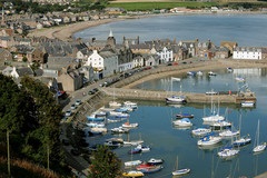
The Banff & Buchan area is located in northern Aberdeenshire and includes the main settlements of Banff, Macduff and Fraserburgh along with a number of smaller coastal and inland settlements. Banff is characterised by an urban environment which includes a designated Outstanding Conservation Area which encompasses the town centre and the harbour/marina areas and includes a wide variety of buildings and structures of historical architectural merit. The neighbouring settlement of Macduff lies to the east on the opposite side of the River Deveron.
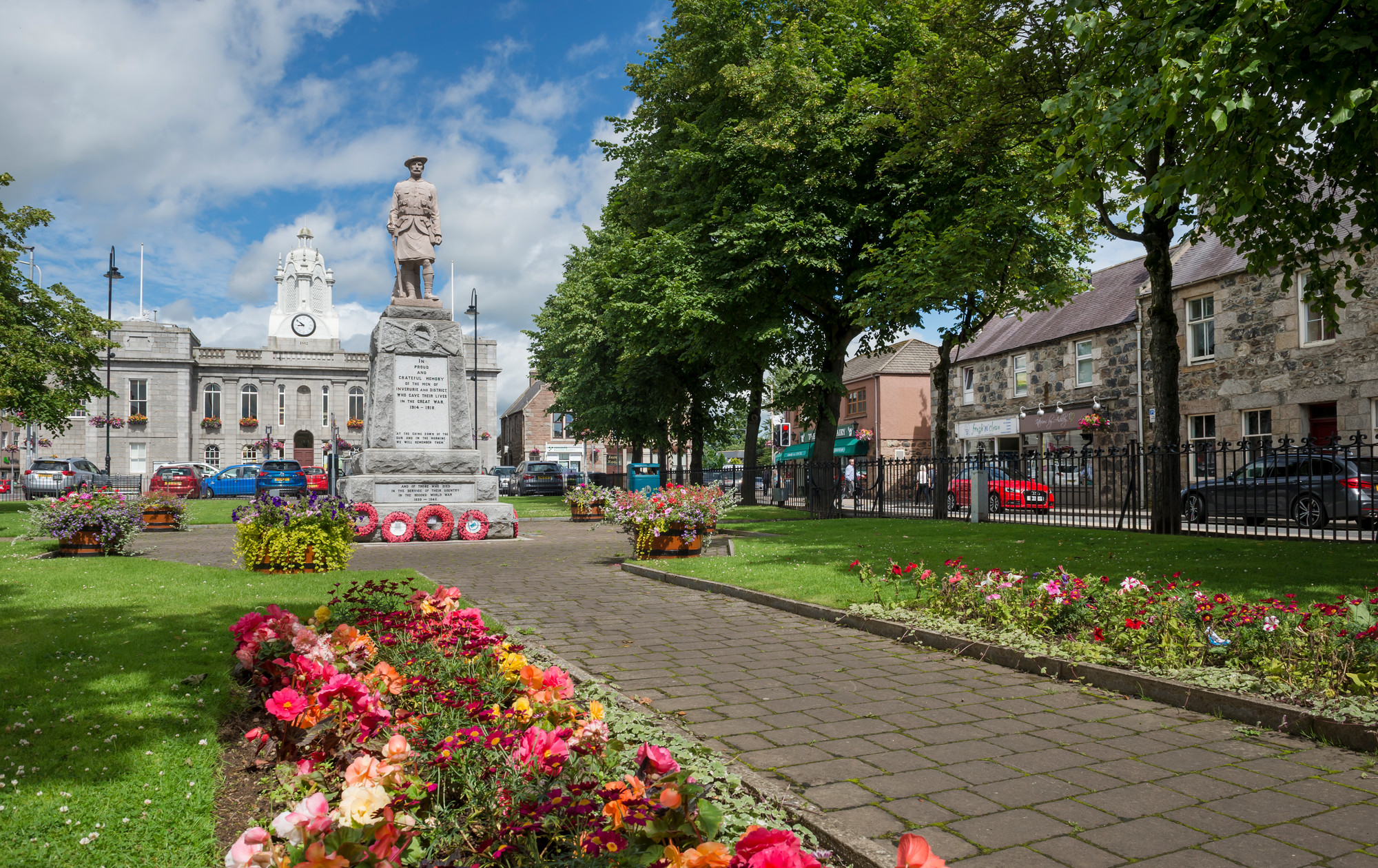
The Garioch area occupies a centralised location within Aberdeenshire and includes the main settlements of Inverurie, Kintore, Newmachar and Westhill. The administrative office is located in Inverurie, a Royal Burgh located 16 miles to the north west of Aberdeen within the valley of the River Don and sits between the River Don and River. This attractive market town has a host of amenities and good connections with Aberdeen by road and is served by a railway station. Bennachie, a hill range popular with mountain bikers and hillwalkers is located 12 miles to the west of Inverurie while a variety of outdoor recreational pursuits are available within a reasonable travelling distance.
 The mix of rural and urban area covered by the Banff & Buchan and Garioch Development Management Team offers opportunities for varied development opportunities. Planning proposals that the team are involved with range in type and scale and include major and local planning applications. A key focus remains on regeneration within the Banff & Buchan area and the Development Management Section having a key role to play by ensuring the delivery of an efficient, effective and consistent Service to assist with the Council’s framework for regeneration opportunities within the towns of Banff, Macduff and Fraserburgh. Examples amongst others, include, large and medium scale residential development, large and medium scale industrial and business proposals, tourism development, smaller scale rural housing and business proposals, renewable energy development including small and large scale wind farm projects, enabling development associated with buildings of historic significance and leisure and community facilities proposals.
Apply now